Puget Sound Management Regions, Marine Preserves and Marine Protected Areas, Limited Commercial Crab, and Non-commercial Areas.
Note: The following maps show approximate boundaries only. Refer to the current regulations for exact boundary descriptions. These maps are not to be used for navigation.
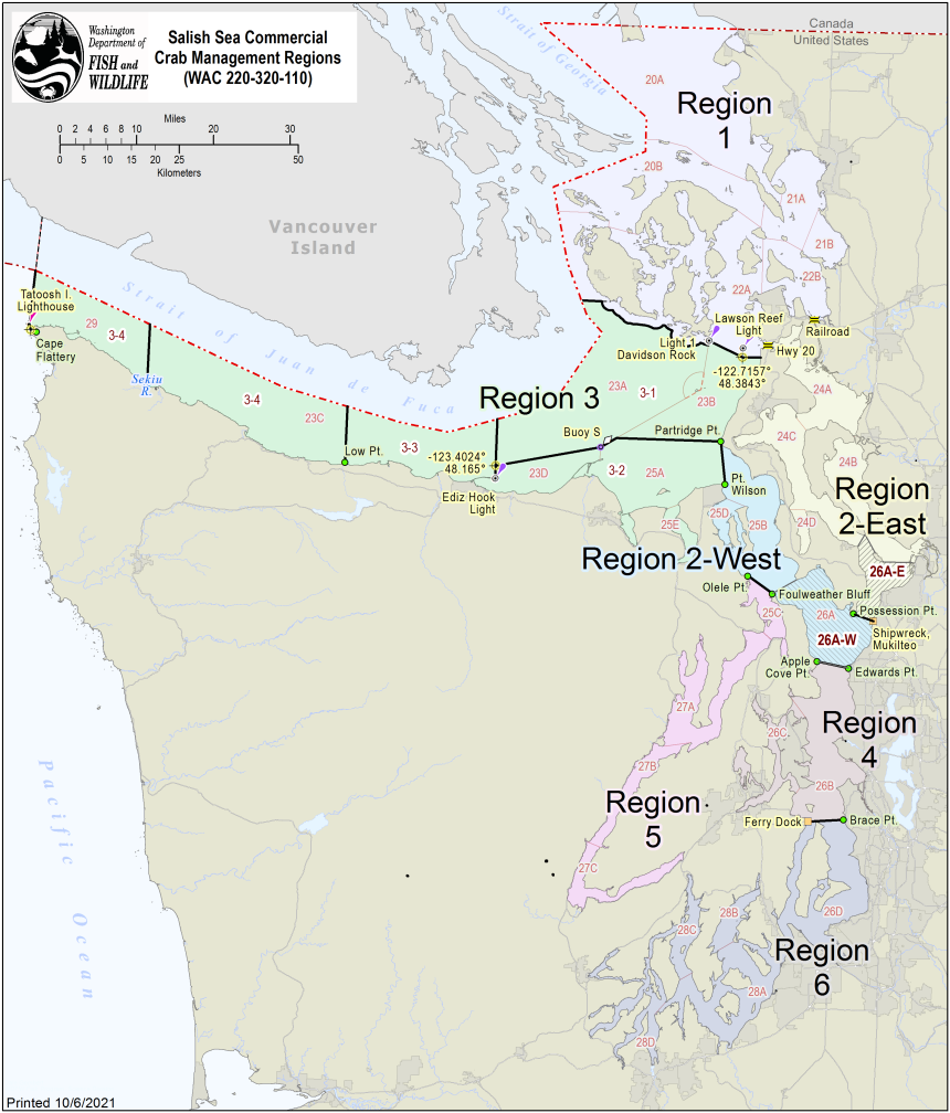
Puget Sound Crab Management Regions
Limited Commercial Areas - Pot Restrictions
The following areas will be open to State commercial crabbing with the indicated pot limits.
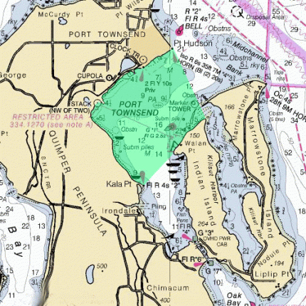
Port Townsend Bay
Those waters of Marine Fish-Shellfish Management and Catch Reporting Area 25D within a line projected from the Point Hudson Marina entrance to the northern tip of Indian Island, thence to Kala Point, and thence following the shoreline to the point of origin will operate subject to a 20 pot per license limit until 11:59 p.m. December 31, 2022.
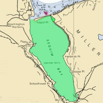
Sequim Bay
That portion of Marine Fish/Shellfish Catch Area 25A south of a line true west from Travis Spit to the Miller Peninsula will operate subject to a 20 pot per license.
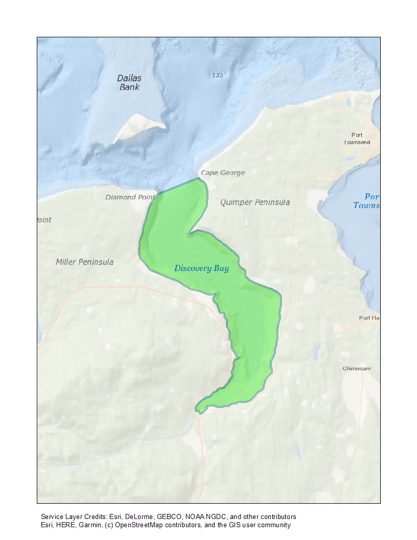
Discovery Bay
That portion of Marine Fish/Shellfish Catch Area 25E south of a line from Diamond Point to Cape George will operate subject to a limit of 20 pots per license.
Areas closed to State commercial crabbing year-round
The following areas are closed to state commercial crabbing year-round. These maps are not to be used for navigation.
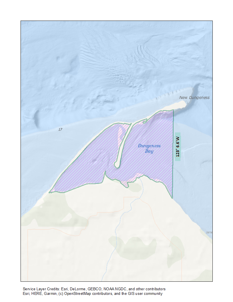
W. Dungeness Bay
Those waters of Marine Fish-Shellfish Management and Catch Reporting Area 25A previously described as 'west of a line from the new Dungeness Light to the abandoned dock at the Three Crabs Restaurant" now described as the Dungeness Bay Special Management Area with includes all waters of Dungeness Bay west of the 123 deg 6.6' Longitude line originating from the New Dungeness Light (48 deg 10.90'N, 123 deg 6.6' W)
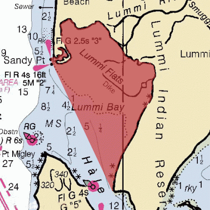
Lummi Bay
Those waters of Marine Fish-Shellfish Management and Catch Reporting Area 20A in Lummi Bay east of a line projected from the entrance buoy at Sandy Point to Gooseberry Point.
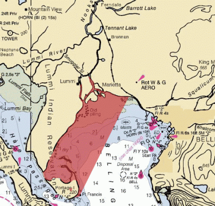
Bellingham Bay
Those waters of Marine Fish-Shellfish Management and Catch Reporting Area 21A in Bellingham Bay west of a line projected from the exposed boulder at Point Francis to the pilings at Stevie's Point.
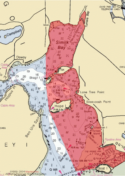
N. Skagit/Similk Area
Those waters of Marine Fish-Shellfish Management and Catch Reporting Area 24A east of a line projected true north from the most westerly tip of Skagit Island and extending south to the most westerly tip of Hope Island, thence southeast to Seal Rocks, thence southeast to the green can buoy at the mouth of Swinomish Channel, thence easterly to the west side of Goat Island.
E. Port Susan Area
That portion of Marine Fish/Shellfish Catch Area 24B east of a line projected from the five meter tower (located between Gedney Island and Priest Point) to Barnum Point and south of a line projected west from Kayak Point, and north of a line projected from the five meter tower to Priest Point.

Region 4
Which includes Catch Areas 26B and 26C.
Region 5
Which includes Catch Areas 25C, 27A, 27B, and 27C.
Region 6
Which includes Catch Areas 26D, 28A, 28B, 28C, and 28D.
Non-Commercial Area - Health Advisory
The following area(s) will be closed to State commercial crabbing until further notice.
Port Angeles Harbor
That portion of Marine Fish/Shellfish Catch Area 23D west of a line from the eastern tip of Ediz Hook to the ITT Rayonier Dock will be closed based on recommendations from the Clallam County Department of Health and Human Services web page.